
Fast inspections.
Trusted data.
Less downtime.
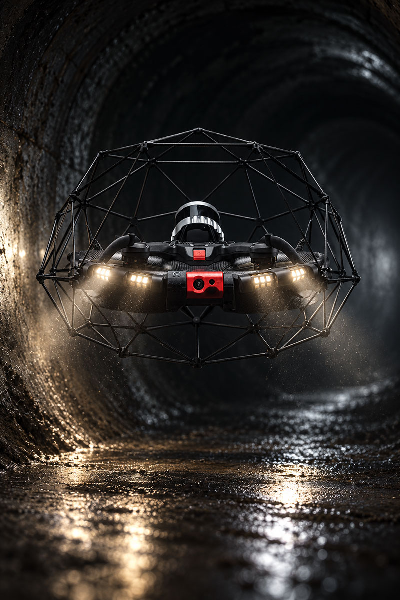
See inside pipes, culverts, tanks, wet wells, and other confined spaces while your team stays safely at the surface. RAM Infrared Services uses the collision-tolerant Elios 3 to capture clear, detailed inspection data without sending anyone inside.
NO ENTRY | 4K QUALITY | THERMAL | LIDAR | 3D MODELS
ELIOS 3 | Collision-tolerant inspection drone
Fast, targeted flights
Focus on the asset or segment you need
More interior coverage
View beyond the pipe invert
Multiple data options
Visual, thermal, and LiDAR capture
Reduce crawler wear
Inspect suspect areas by drone first
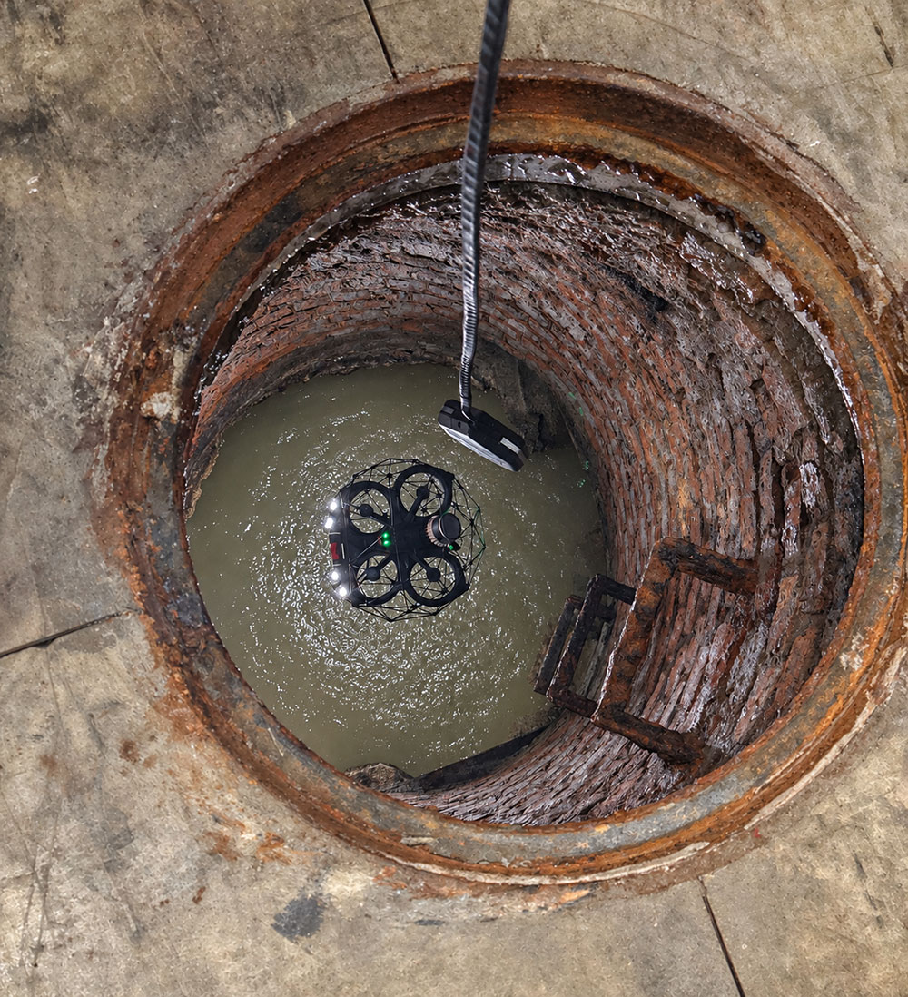
Go where crawlers can’t.
We complement crawler and engineering inspection programs, flying the segments they can’t reach.
Our drone flies through the center of the pipe, above the invert, to see beyond debris, silt, and standing water. Get a clear view of infrastructure condition, connections, and areas traditional crawlers can’t go.
See beyond the bottom of the pipe
A crawler travels along the pipe invert. The drone can fly through the center and capture views around the interior, including sidewalls and upper surfaces.
Support stormwater programs
Add aerial visual and LiDAR data to stormwater inspection workflows for accessible culverts, drainage structures, and conveyance assets.
Inspect challenging confined spaces
Capture visual data in pipes, culverts, tanks, wet wells, vaults, tunnels, and other GPS-denied or other confined spaces.
Fill specific data gaps
Target one-off segments, short runs, offsets, vertical transitions, or areas where crawler data is incomplete or difficult to capture.
Reduce risk to crawler equipment
Use a drone to look at suspected fragile or damaged areas before sending crawler equipment into conditions that could snag or damage it.
Point-cloud measurements
Measure distances, diameters, and cross-sections from captured data, without a return trip to the site.
Where Elios 3 Inspections Can Help
RAM Infrared Services provides targeted drone inspections for suitable, accessible confined spaces and enclosed infrastructure.
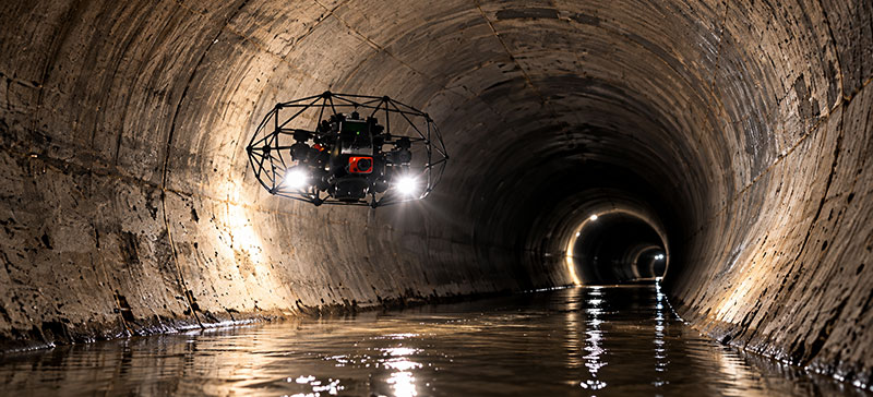
Stormwater & Drainage
Inspect culverts, drainage tunnels, and stormwater conveyance structures.
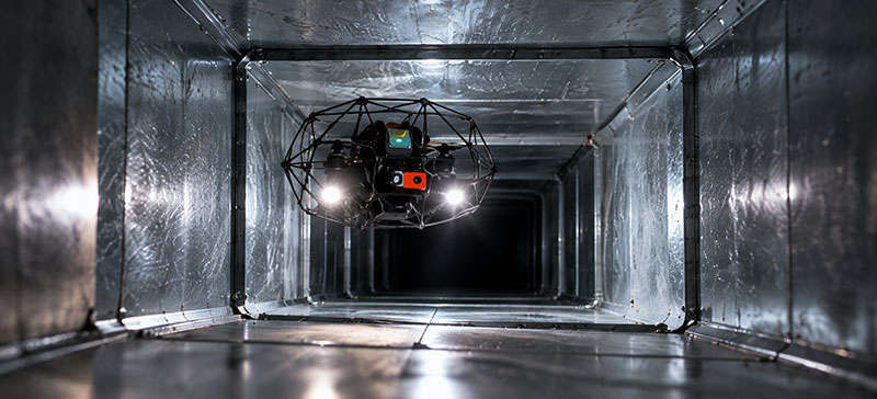
HVAC & Building Systems
Capture inspection data inside ductwork, air-handling systems, mechanical shafts, and utility spaces in large facilities.
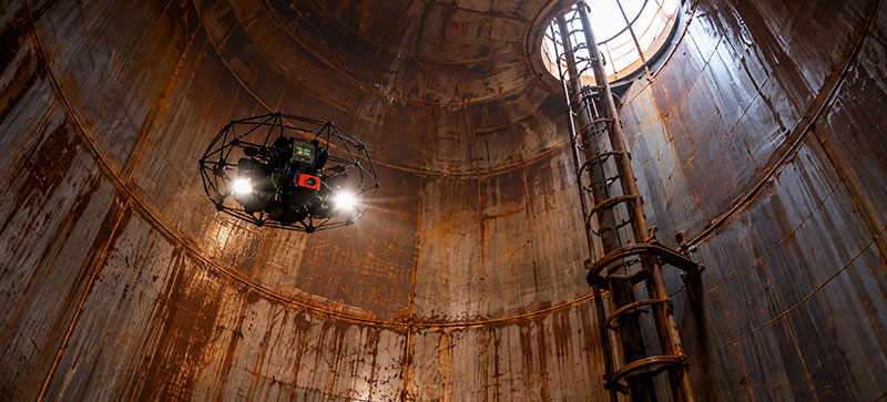
Industrial Confined Spaces
Inspect accessible tanks, silos, boilers, chimneys, and process ducts.
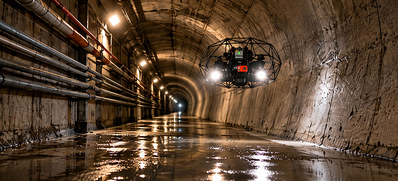
Tunnels & Utility Corridors
Document accessible service tunnels, utility corridors, and other GPS-denied spaces..
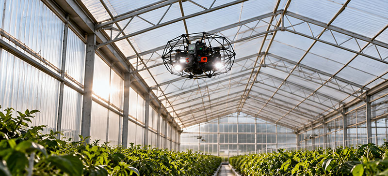
Enclosures & Large Structures
Look for visible openings, tears, or separations in greenhouses and similar enclosed structures.
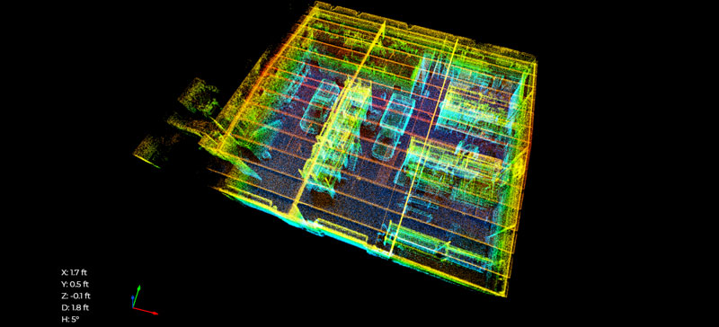
3D Documentation & Repeat Inspections
Capture visual records and LiDAR point clouds to document assets and support future comparisons.
You get more than video. You get data you can measure.
High-resolution inspection video and LiDAR point clouds provide the visual and spatial data you need to assess asset conditions, take measurements, and plan with confidence.
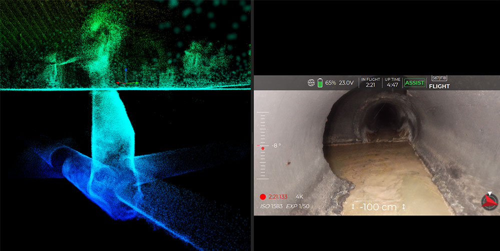
Inspection video with LiDAR data
See condition and capture precise spatial data
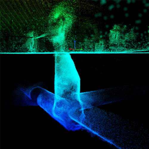
3D point cloud model
Map underground assets and identify features with confidence
Capture the view. Keep the data.
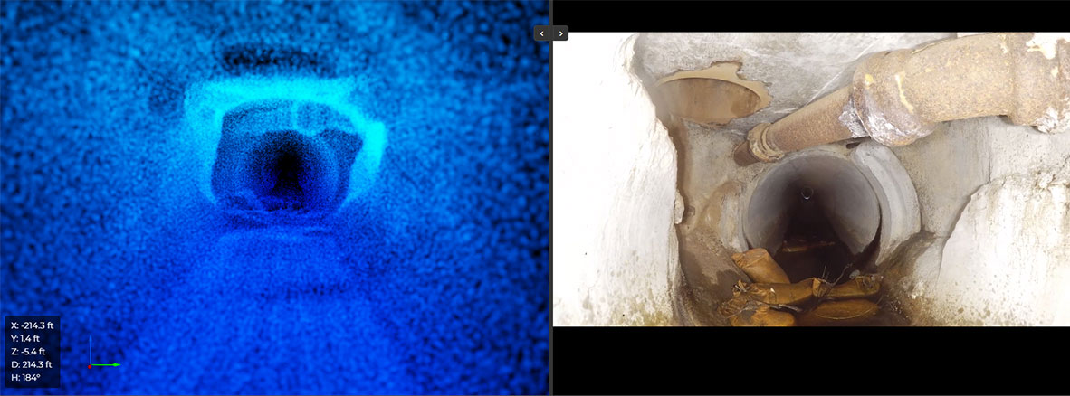
Choose the inspection data that fits the asset and project. Deliverables depend on the selected payload and scope.
01
Inspection video with LiDAR data
High-resolution footage with onboard lighting for reviewing interior conditions.
02
Thermal imagery
Thermal views can help document heat patterns and temperature differences when relevant to the inspection.
03
LiDAR point clouds
Capture spatial data for viewing distances, diameters, and cross-sections directly from the point cloud.
04
3D asset models
Build a digital record for review, sharing, and comparison during repeat inspections.
See how an Elios 3 inspection could work at your site.
Request a free drone demo and see the Elios 3 in action. We’ll show how its collision-tolerant design can access confined spaces and capture detailed inspection data, then discuss how it could support your project.
From project details to useful data.
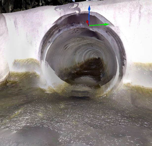
High quality video, point clouds, and 3D models in your required format. Defect coding and condition assessment stay with your team.
One flight captures 4K video, thermal imagery, and LiDAR through through confined unground infrastructure and GPS denied environments.
01
Tell us what needs inspection
Share the asset type, location, access conditions, and what your current inspection method is missing.
02
Scope the right approach
We review access, safety, project goals, and the data options that fit the site.
03
Capture and deliver
We complete the agreed flight and provide the captured data in the format outlined for your project.
Have an inspection project or looking for a free demo?
Tell us a little about the asset and what you need to see. We’ll follow up to discuss the inspection approach or review your free-demo application.
Call 267-382-7831
info@raminfrared.com
Does the drone replace a crawler?
The Elios 3 is designed to complement existing inspection methods. It can help cover segments, surfaces, or spaces where a crawler may have limited access or may not capture the view you need.
What kinds of spaces can you inspect?
The Elios 3 is designed to complement existing inspection methods. It can help cover segments, surfaces, or spaces where a crawler may have limited access or may not capture the view you need.
Can I apply for a free demo?
Yes. Free demonstration requests are reviewed for qualifying projects. Location, access, site conditions, safety, scope, and scheduling restrictions apply. RAM will confirm eligibility before scheduling.
Will RAM provide a condition assessment?
RAM delivers the captured data in the agreed format. Defect coding and condition assessment remain with your engineering or asset-management team.
Before you request an inspection.
Every asset is different. Share the details and we can help determine whether a drone inspection fits your project.